 |
|
 |
The orange circle in the first map shows the place of the other two maps (scroll down).

The islands of Svalbard, Spitsbergen is the main island.
See the map above: The pink stip in the orange circle is the location of my basecamp.
Left under in the orange circle is the Norwegian settlement Longyearbyen.
See map below: The red line shows the route of the 19 days White Water Kayak & Riverboard Tour.
The start is at the fjord in Ebba-dalen or Ragnerdalen. The end of the trip is at the fjord in Ebba-dalen.
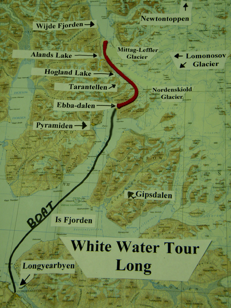
The route of the 19 days White Water Kayak & Riverboard Tour.
See map below: The red line shows the route of the 9 days White Water Kayak & Riverboard Tour.
The start is at the fjord in Ebba-dalen. The end of the trip is at the Nordenskiold glacierfront.
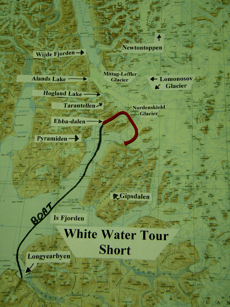
The route of the 9 days White Water Kayak & Riverboard Tour..
 Go to the 2 White Water Kayak & Riverboard Tours.
Go to other Maps.
Last update on June 11th 2009

The islands of Svalbard, Spitsbergen is the main island.
The route of the 19 days White Water Kayak & Riverboard Tour.
The route of the 9 days White Water Kayak & Riverboard Tour..
Go to the 2 White Water Kayak & Riverboard Tours.