 |
|
 |
The orange circle in the first map shows the place of the second map (scroll down).

The islands of Svalbard, Spitsbergen is the main island.
See the map above: The pink stip in the orange circle is the location of my basecamp.
Left under in the orange circle is the Norwegian settlement Longyearbyen.
See map below: The red line shows the route of the Walking Tour from West- to East Spitsbergen.
The start is at the Von Post glacierfront. The end of the trip is on the boat at the East coast.
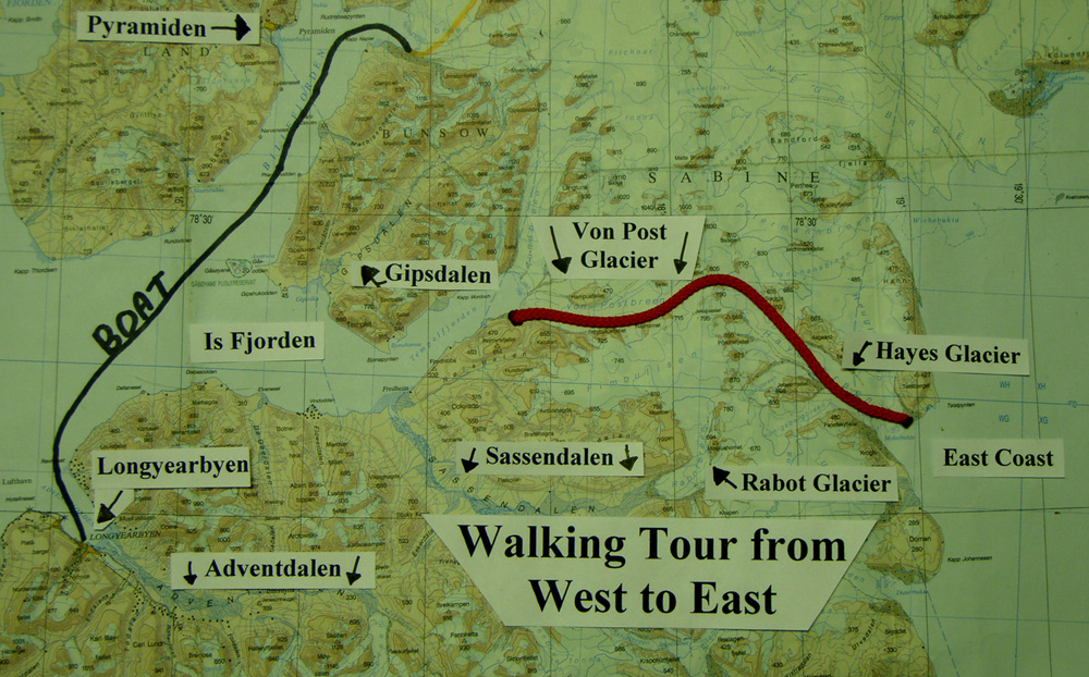
The route of the Walking Tour from West- to East Spitsbergen.
 Go to the Walking Tour from West- to East Spitsbergen.
Go to other Maps.
Last update on June 11th 2009

The islands of Svalbard, Spitsbergen is the main island.
The route of the Walking Tour from West- to East Spitsbergen.
Go to the Walking Tour from West- to East Spitsbergen.