This is a story of one of those days in the mountains when everything works out really good. Being at the right place at the right moment (nice weather).
This walk around Templet mountain on thursday August 14th 2008 was the last day of a 9 days trip from Nordenskiold Glacier to Tempelfjorden.
In May 15th 2008 I saw this area really good in nice weather, during my scooter pickup at the end of my Newtontoppen expedition. Especially the area around the Bolton- and Murdochglaciers was nice.
So I went back to this area this summer on Wednesday August 6th 2008.
On Thursday August 7th I did some riverboarding at the Nordenskioldglacier on the same glacierriver as last year.
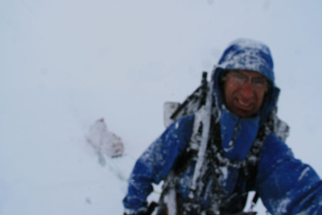
Heavy snowfall on the top (550m.) of the Murdochglacier (point 7 on map)
The pulk (sledge) behind me is normally red coloured!
When I was walking up the Bolton glacier on Sunday evening August 10th, it starts snowing, just like it did on Saterday the 9th. Only this time it keeps snowing for 2 days. I camped 2 days on the top of the Boltonglacier in completely white out conditions. I could have walk down the Murdochglacier to get out of the white out, but then I should have camped lower with maybe rain instead of snow. Snow is better, that's why I camped high on the glacier.
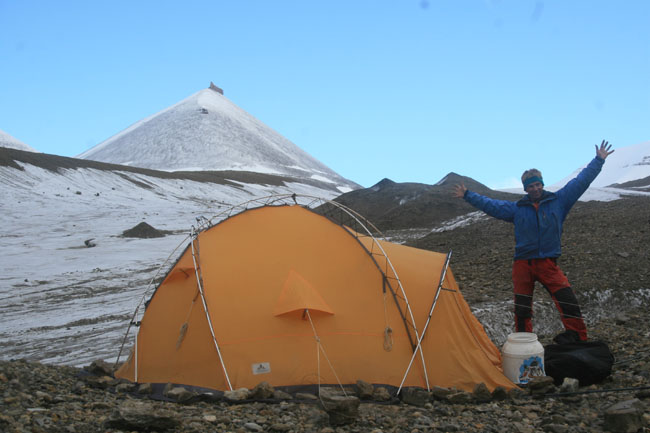
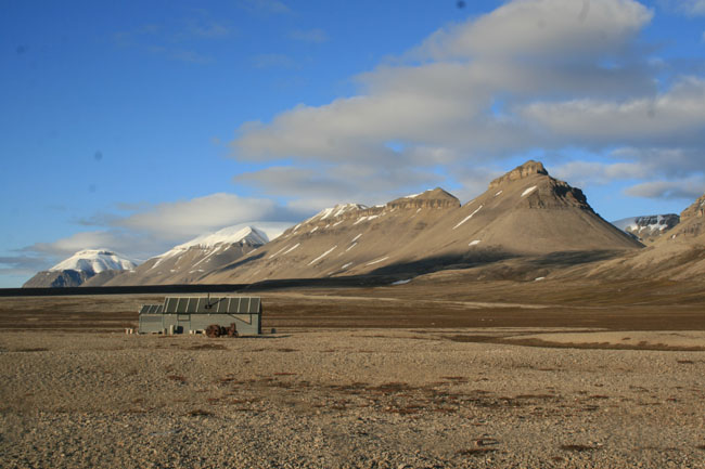
Campsite at the end of the Murdochglacier (point C on the map).
On Wednesday August 13th at 02.30 am I walked down the Murdochglacier, pitched my tent at the end of the glacier and walked down the first part of my equipment to the pick-up place (point 1). Even on Wednesday it was sometimes snowing but I heared that the weatherforecast was good for the next days.
On Thursday (Yes, nice weather) I started to walk at 11.30 a.m., I took my pulk with me on my backpack and dropped it at the pick-up place (1).

Walking from the campsite to the fjord (point 1) with a pulk on the backpack.
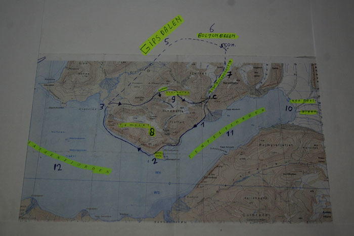
Detailed map with Templet Mountain (8) in the middle, the blue line is the followed route.
I was still not sure how my pick-up was arranged. But when I reached my fooddepot at point 2, I saw a small boat close to the shoreline.
Yes, this was the boat who is going to pick me up tomorrow at 11.00 a.m..
After some talk with the man from the boat, I took some nice food and fuel from my fooddepot in my backpack. The man transported my fooddepot (one big barral with food for one week) to his boat. I should meet him and his boat tomorrow.
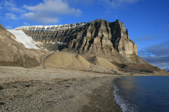
The South-East side of Templet Mountain (point 2).
Now I could start to walk under the steep Templet Mountain. The sun was in the right position. Many times I changed the lens of my camera, so many things to see. Allthough the steep rock of Templet Mountain is not higher then 650 meter, it looks much higher because it is so close to me and close to the seaside.
Under these circumstances (sun, less wind, easy base, relative light backpack and beautiful landscape) it was very nice to walk along the sea side of Templet Mountain.
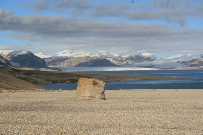
View from point 2 over Tempelfjorden (11) towards von Post glacier (10).
a low view over a small river towards the South-West side of Templet mountain.
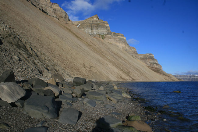
It is only possible to walk at the sea-side at Templet mountain at low tide and good weather (less wind).
The West-side of Templet mountain were a small and steep glacier is coming down.
At the end of Templet Mountain I walked into Gipsdalen and took a long break outside a mountain cabin (point 3).
From here there were 3 options for me to continue this walk:
A: walk the same way back (it was still low tide)
B: walk up a unknow valley and follow a glacier who goes over the mountainplateau Storholen.
C: walk up gipsdalen (5) for 12 km and walk up again Boltonglacier (6) and down Murdochglacier.
Looking into Gipsdalen (5) from a mountaincabin (closed) at point 3.
New snow on the higher mountains in the background
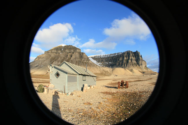
Looking towards Templet mountain with an old iron tractor beside the mountaincabin.
Options A and C were safe options. Option B was the adventurous one, but with the risk that it might be impossible to walk up the unknow steep valley.
I must be the next day at 11.00 a.m. at the fjordside (1), What shall I do??
After some considerations I choose for the safe option C. I filled up my thermos bottle with hot water and packed my backpack and started walking again.
But the strange/funny thing took place that my feets were walking into the direction of the unknow valley. Why?? I do not know.
I keep on walking up the unknow valley and the views became better and better. The late evening sun (now with more clouds) shining on some parts of the mountains did give very special views.
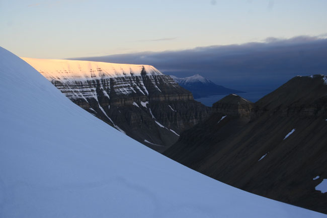
Evening sun on the backside (Northern side) of Templet mountain.
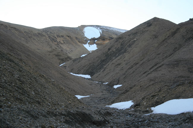
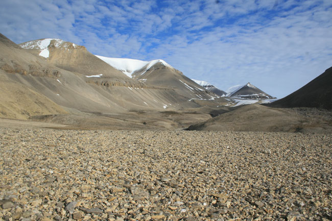
Walking up the unknow steep valley towards the Sand glacier (4).
It was possible to walk/scramble up the unknow steep valley. As expected, after so many days with snowfall, I walked up the Sandglacier through deep snow. Slowly I reached the top of the Storholen mountain plateau (9). There was some kind of special light on the mountains around me (sadly, you do not see this light on my pictures) and it was very nice to be here at this time of the day (night).
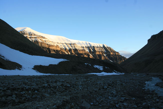
Night sun on Templet mountain, picture taken from the Sand glacier.
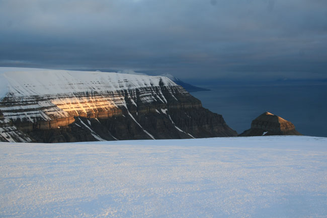
Night sun on Templet mountain from Mountainplateau Storholen (9).
It was easy to walk down the steep glacier, south west of Storholen, with so much snow on the glacier.
I was highly concentrated when walking down over many rocks towards the Murdochvalley.
At Friday 5.00 a.m. I reached my tent (C). I could sleep for 2 hours, but I did not go to sleep. The risk of not waking up at time was too high. I took some rest, eating a late dinner (or an early breakfast), braking down my tent and packed my backpack.
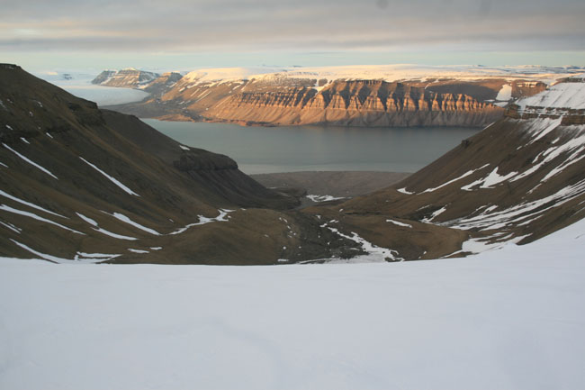
Walking down a steep glacier from Storholen with a nice view over Tempelfjorden (11) and von Post glacier (10).

The way to get back to my tent (orange spot in the background): walk over the high ice bridge, exciting!.
I walked down (very slowly) for the 3th time from my campsite (C) to the pick-up place (1) with a heavy loaded backpack. At 10.00 a.m. I dropped of my backpack at the fjordside. Yes, I made it in time!! This was a remarkable trip in the Spitsbergen Mountains. 32 kilometres long, walking over rocks, following the seaside, walking over snow, crossing glaciers.
On trips like this you see a lot of Spitsbergen.
The Murdoch valley, seen from the sea-side.
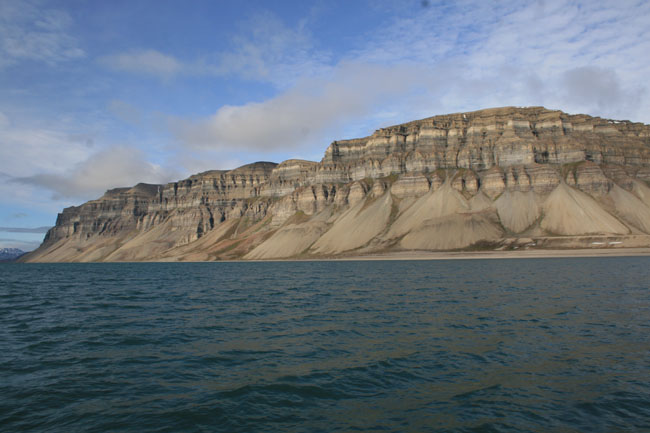
The 6 km. wide rock formation of Templet mountain seen from the boat .
Special thanks to Johan Sletten from Svalbard Reiser for arranging my food depot, picking up the food depot and picking up me up at friday at point 1.
I shouldn't/couldn't make this amazing daytrip if the pick up of my food depot was not arranged.
And by picking me (and my whole equipment) up on friday, I was able to get the boat to Oscar 2 land on Saterday.
On Saterday it was perfect weather and through that I could go for some exiting riverboard activities in front of the Esmarkglacier before I started my ski-tour in Oscar 2 land.
See my next story.
Sometimes it is sad that a human being has to sleep, especially on those moments when there is good weather!!!
 Click here to go to other amazing expeditions.
Last update on September 24th 2008